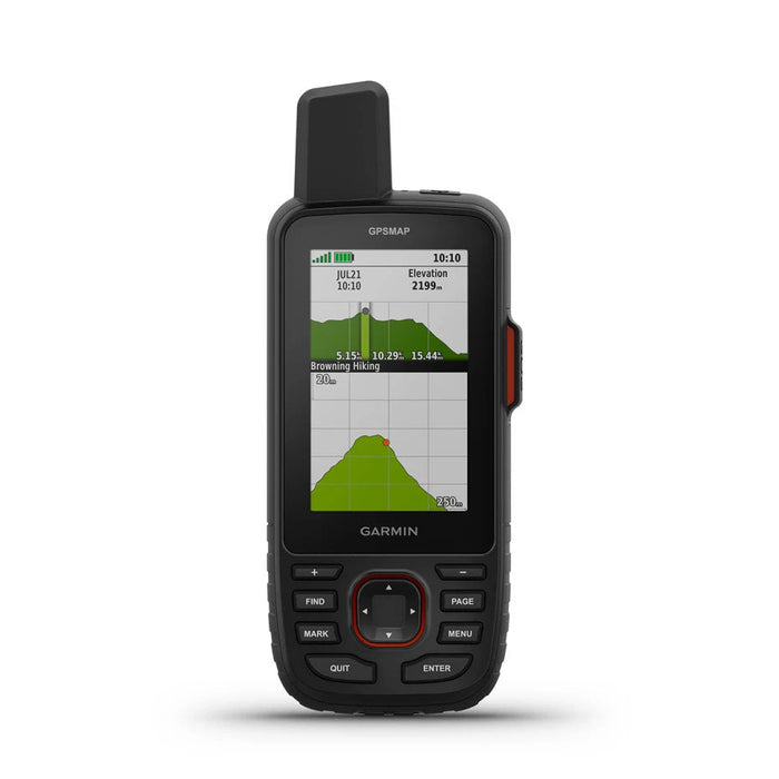
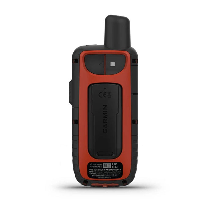
At the heart of critical missions, the Gpsmap 67i from Garmin stands out for its durability and advanced features, designed for demanding professionals. Equipped with resistance that meets MIL-STD-810 standards, this device guarantees unfailing reliability in the most hostile environments. Its multi-band technology and extended GNSS support ensure precise position tracking, even under the most challenging conditions. With exceptional battery life and two-way communication capabilities, the Gpsmap 67i is an essential ally for maintaining contact and safety during field operations.
Technical Information
- Type: GPS
-
Benefits:
Extend your adventures with a battery life of up to 165 hours in tracking mode and 425 hours in Expedition mode.
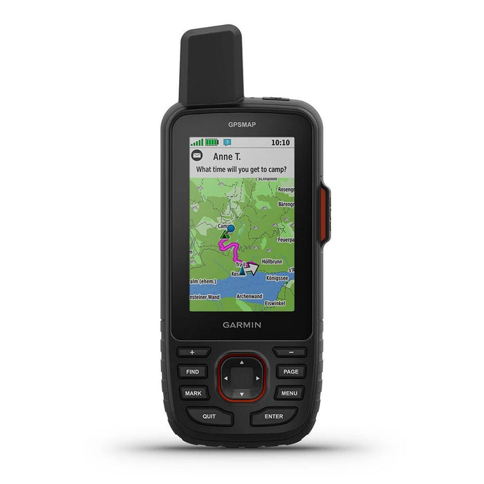
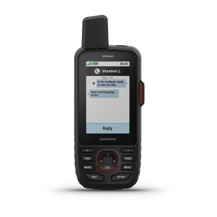
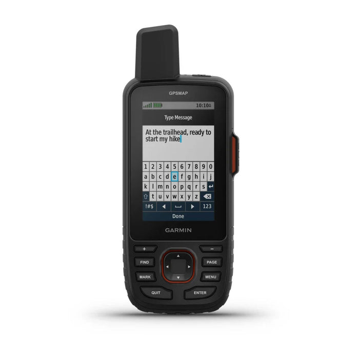
Two-way messaging lets you share the best moments with your loved ones.
Give your loved ones the ability to follow your adventures with position tracking.
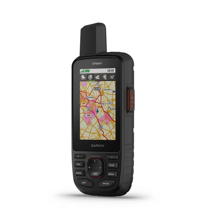
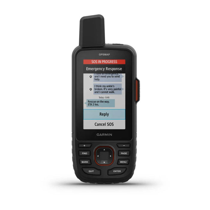
Have an emergency? Send an interactive SOS at any time, anywhere in the world.
Track your position in difficult conditions with multi-band technology and extended GNSS support.
- Water Resistance Rating: IPX7
- MIL-STD-810: Yes (temperature, shock, water); device only
- Display Type: Transflective color TFT screen
- Display Format (W x H): 3.8 x 6.3 cm (1.5″W x 2.5″H); 7.6 cm diagonal (3″)
- Screen Resolution (W x H): 240 x 400 pixels
- Battery: Internal and rechargeable lithium-ion
-
Battery Life:
Up to 180 hours (> 7 days) in default mode
Up to 840 hours in Expedition mode - Memory/History: 16 GB (user space varies depending on included maps)
- Interface: USB-C
-
Maps and Memory:
Preloaded maps (TopoActive Europe; routable on roads and trails)
Possibility to add maps
Base map
Automatic routing
Map segments (15,000)
BIRDSEYE
Includes detailed hydrographic features (coastlines, lake and river shores, wetlands, and both seasonal and permanent streams).
Includes points of interest with search function (parks, campgrounds, viewpoints, and picnic areas).
Displays national, federal, and local parks, forests, as well as natural parks
Storage capacity and power (up to 32 GB microSD™ card)
Waypoints (10,000)
Courses (250, 200 course points per course)
Tracks (250)
Track log (20,000 points, 250 gpx tracks saved, 300 fitness activities saved)
Activities
Routes (250, 250 points per route; 50 points for automatic routing)) -
Sensors:
GPS
GLONASS
GALILEO
QZSS
BEIDOU
IRNSS
Barometric altimeter
Compass (3-axis with tilt compensation)
High-sensitivity receiver
GPS compass (while moving)
Multi-band frequencies
-
Smart Daily Functions:
Connect IQ™ (watch faces, data fields, widgets, and apps downloadable)
Smart notifications on the wearable device
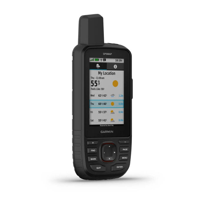
Dynamic weather
VIRB® remote
Compatible with Garmin Connect™ mobile
-
Tracking and Safety Features: LIVETRACK
-
Outdoor Recreation Features:
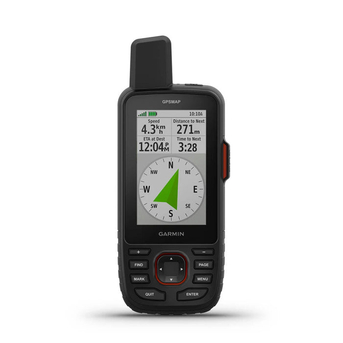
Point-to-point navigation
TracBack®
Area calculation
Hunting/fishing calendar
Moon/sun information
Xero™ positions
Geocaching mode(real-time treasure hunting)
Custom maps compatible (500 custom map areas)
JPEG viewer
LED beacon
-
inReach® Features:
Interactive SOS
inReach weather
SMS exchange with mobile numbers and email addresses
SMS exchange with other inReach devices
Position sharing with other inReach devices
MapShare compatible with tracking
Virtual keyboard for custom messages
Sending waypoints to MapShare during the journey
Sending a selection of routes to MapShare during the journey
-
Outdoor Applications:
Compatible with Garmin Explore™ for waypoints, tracks, routes, and activities
Compatible with Garmin Explore website
- Connections: Wi-Fi, Bluetooth, ANT+
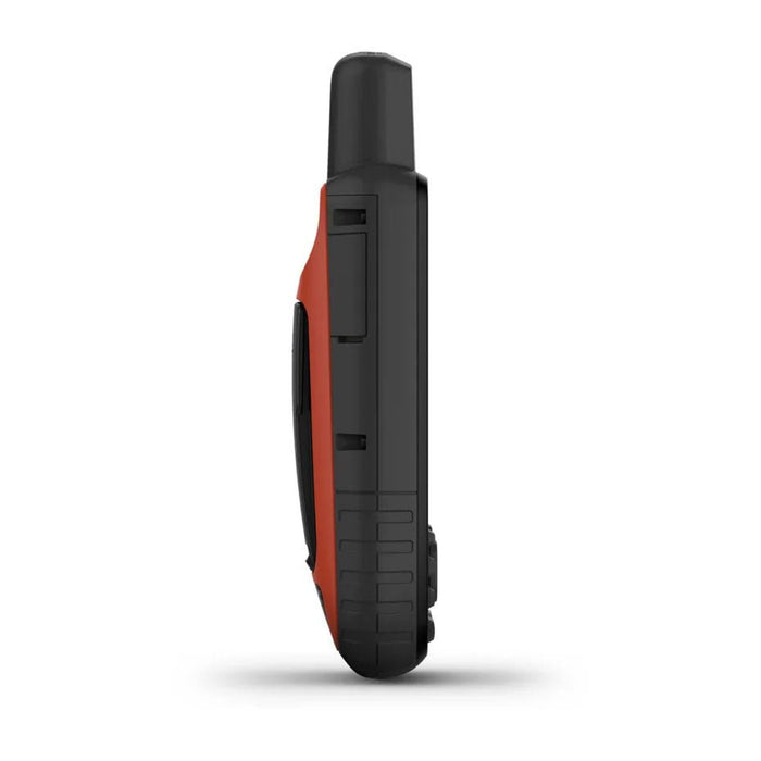
- Weight: 230 g with battery
- Dimensions: 6.2 x 16.3 x 3.5 cm
Metropolitan France
- Standard (2-3 days): 6.95€ or Free for orders over 59€
- Mondial Relay pickup points: 4.50€ or Free for orders over 59€
- Express (24 working hours): from 10.95€
Military Postal Sector
- Standard (variable delay according to MP): 6.95€ or Free for orders over 59€
Tax-Free
If the MP address is located outside the EEC, you can benefit from tax-free billing (excluding VAT), excluding shipping costs, provided that you send us by e-mail a Military Position Certificate (MPC) corresponding to the period during which you placed the order. Without this MPC, you will not be able to benefit from the VAT exemption.
Belgium
- Standard (2-5 days): 8.95€ or Free for orders over 59€
- Mondial Relay pickup points: 4.50€ or Free for orders over 59€
International
For all shipments outside Metropolitan France, the amount of shipping costs is calculated based on the weight of the package and the country of destination. The delivery fees will be displayed in your cart before the payment of your order.
Learn more about our delivery methods our delivery methods
Product Return
You have a 30-day withdrawal right from the receipt of your order to request a return of one or more items for an exchange (free), a credit note, or a refund (in the latter two cases, a contribution to the return costs of 1.95 euros will be applied for the following countries: Metropolitan France, Belgium, Germany, Luxembourg, Monaco, Andorra). In case of an error on our part or a manufacturing defect, the return costs will be at our expense.
Important
For returns from the DOM-TOM, and other countries inside and outside the EEC, return costs are the responsibility of the customer.
Learn more about our Return Policy